The concept of Information Cartography (IC) has evolved and matured over time. It was not originally envisioned as a context-independent tool for visualizing and analyzing just about any data, information or knowledge from any source. The first use of the term Information Cartography was by Carol Hildebrand in an article on Information Mapping, Guiding Principles in CIO Magazine, July 1, 1995, in relation to mapping the intellectual capital ("the skills, expertise and information that make up their pool of knowledge") within organizations. She attributes the concept to earlier developments:
Hildebrand's use of the term Information Cartography is not defined by her; does not include visualization, and is specific to the organizational context:
That is not to say she was not using the full cartographic metaphor: "Organizations that do devote time and effort to charting the geography of information are finding that a relatively small investment can yield some big benefits" (emphasis added). But the mapping she had in mind appears to be more of the mathematical function type--indexical mappings from one situation to another in order to find something--as opposed to spatial mapping, where the representation of relationships among things is the main goal. Hildebrand also coins the term used for IC exponents, information cartographers.
The first definition of the term, along with a clear outline of the vision, was by Stephen Paling in 2000. His presentation to an American Society for Information Science and Technology (ASIST) SIG/CR discussion group was entitled, Information Cartography: A Proposed Model for Access to Heterogeneous End-User Databases. His Introduction follows:
The new elements that Paling introduces are navigation (as opposed to the static guides proposed by Hildebrand), including moving between levels (zooming), panning, and a kind of fish-eye view that supports the maintenance of orientation by the user (his original discussion paper).
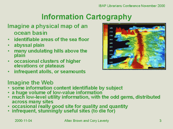
The first description of information cartography, and the use of the term applied to information independent of context (contexts such as corporate strategic intelligence or heterogeneous databases), was by Allen Brown and Corey Laverty at a workshop for librarians at the 2000 SEALS (Southeast Asian Linguistics Society) conference. Defining the primary facets of advanced web searching, their vision draws an analogy between a map of the "sea floor with plains, hills, plateaus [sic] and atolls," and
some information content identifiable by subject, a huge volume of low-level information, much low-level utility information, with odd gems, distributed across many sites, occasional really good site for quality and quantity, and infrequent, stunningly useful sites” (Brown and Laverty 2000, [Information Cartography]).
It appears that the first implementation of the general concept was by Wise, Thomas, Pennock, Lantrip, Pottier, Schur and Crow (1995): "this paper describes an approach to IV [Information Visualization] that involves spatialising text content for enhanced visual browsing and analysis."
The first use of topological visualization (1995) was SPIRE (Spatial Paradigm for Information Retrieval and Exploration) from the CIA-funded, Department of Energy's Pacific Northwest National Laboratory, PNNL. The PNNL has developed a range of tools which share attributes with Information Cartography. For example, Galaxies, and ThemeView (see also Cartia, below).
The concept of Information Cartography is implemented most seriously by André Skupin. He doesn't call it "information cartography" but his work epitomizes it. His article Spatial Metaphors for Visualizing Very Large Data Archives (Skupin and Buttenfield, 1996) was one of the first to explicitly link GIS via the mapping metaphor to non-geographic data. Since that time Skupin has developed methods for spatialising non-spatial data in order to utilize the extensive functions available within GIS software to model common types of non-geographic data.
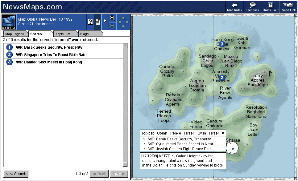
The first commercial use of Information Cartography was by Cartia, a spin-off from the PNNL, around 1998. It was used, for example, to visualize the cumulated contents of newspapers, emphasizing key words such as "bomber". The company and product (called ThemeScape) were "bought out," and the proprietary software is now used for visualizing patent searches. Martins Dodge's Atlas of Cyberspace shows the only evidence that it existed.
The term information cartography has been used elsewhere without the same semantics as used here, though with some of the same connotations. For example Nicolle, Amghar, & Pinon (2000) use it in relation to data architectures, while Lamirel, Hsiang, and Liu use "neural information cartography" in relation to neural-network competitive learning in SOMs (self-organizing maps) .
Brown, A., and Laverty, C., (2000). Searching the Web. IBAP Librarians Workshop, SEALS Conference, Singapore 28-30 Nov 2000. [PowerPoint]
Hildebrand, C. (1995). Information Mapping, Guiding Principles. In CIO Magazine (July 1, 1995).
Paling, S. (2000, November). Information cartography: A proposed model for access to heterogeneous end-user databases. Paper presented at the ASIS&T SIG/CR Idea Mart, Chicago, IL.
Nicolle, C., Youssef Amghar, & Y., Pinon, J-M. (2000). Interrogation System Architecture of Heterogeneous Data for Decision Making, 6th Conference on Content-Based Multimedia Information Access, RIAO 2000, Paris France, April 12-14, 2000, pp 812-818. Available http://lisi.insa-lyon.fr/~amghar/ => NAP00.PS
Lamirel, J-C, Hsiang, J, and Liu, W.J., (2002). Using a Background Neural Model in a Digital Library. 3rd Sino Franco Workshop On Multimedia And Web Technologies, March 26-28, 2002.
Wise, J. A., Thomas, J. J. , Pennock, K. , Lantrip, D. ,
Pottier, M. , Schur, A., and Crow, V. (1995).
Visualizing the Non-Visual: Spatial Analysis and Interaction with
Information from Text Documents, presented at InfoVis '95, Atlanta GA,
1995.
Return to Information Cartography